Streetscope is a service to allow people, but especially computer programs, to submit an address like '123 Main St.' and find its lat/lon coordinates and canonical parcel_id in the Lexington, KY Property Value Administrator's set of addresses.
City agencies in Lexington sometimes disagree on the correct way to reference a single address or taxlot. (And sometimes someone entering data just makes a typo. Oops!) That makes it really hard to get a complete picture of a single property.
Streetscope allows different databases to know they're talking about the same address, even if it's not spelled exactly the same. It returns a geographic location and a parcel ID for matching addresses across databases to enable connections between these datasets and get a true picture of the city.
- Accept files to geocode as a batch
- Emit performance metrics to indicate when this geocoder varies from other geocoders in geographic distance or ability to match an address
- Generalize for any city that has a reliable address dataset
Lexingteam!
with Chattanooga fellow Jeremia Kimelman
and with completely indispensable help from Jonathan Hollinger and Shaye Rabold at Lexington-Fayette Urban County Government and David O'Neill, the Property Valuation Administrator.
(This section remains from lexington-geocoder)
When programming, make an HTTP GET request to http://lexington-geocoder.herokuapp.com/geocode?query=449+w+4th
The geoJSON response:
{
"type": "FeatureCollection",
   "features": [
       {
          "type": "Feature",
          "geometry": {
            "type": "Point",
            "coordinates": [
              -84.4949386945456,
              38.055285154852555
            ]
          },
          "properties": {
              "formatted_address": "449 W FOURTH ST",
              "parcel_id": "15602150"
          }
       },
       ... { more features }
   ]
},
The json result can be previewed through the HTML UI. 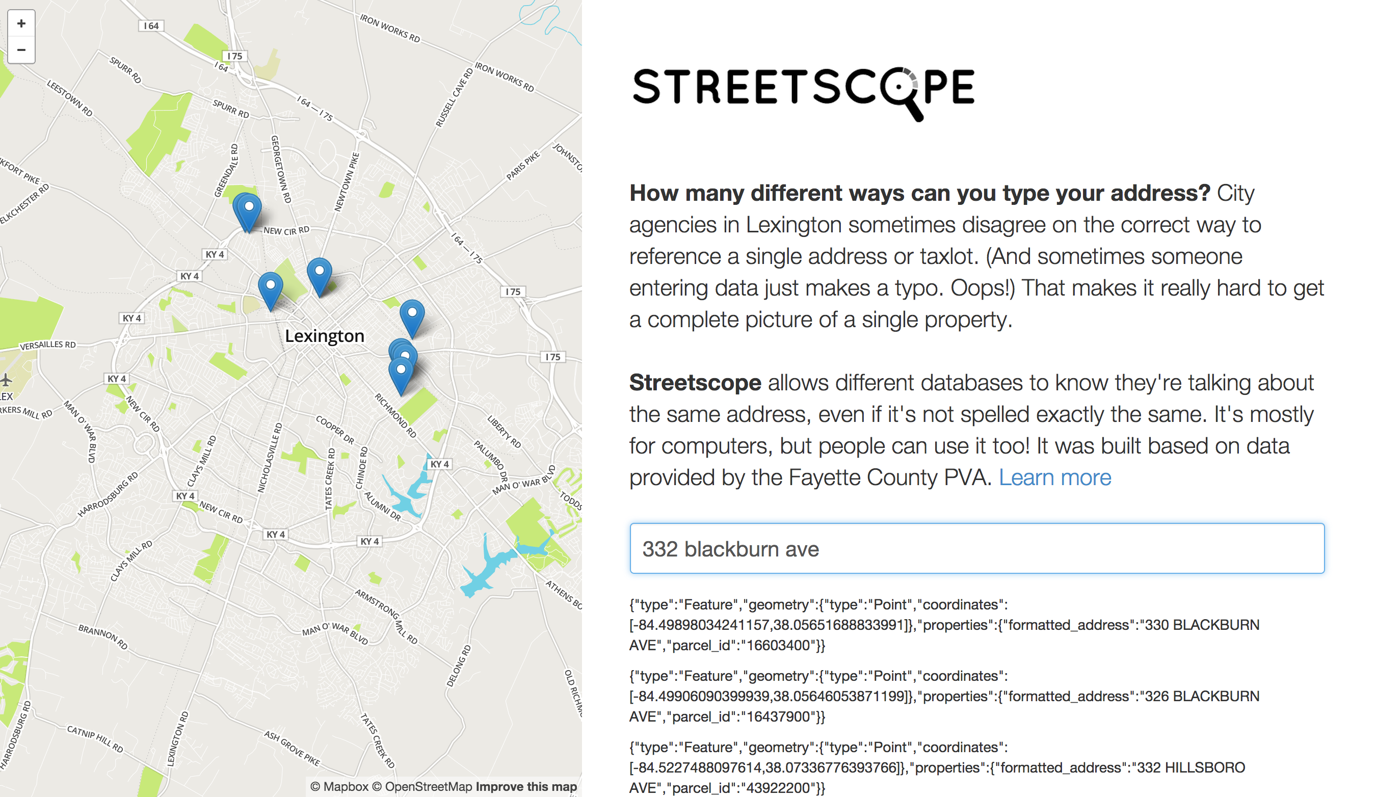
- Install Elasticsearch or for osx homebrew users
brew install elasticsearch - Install Python and Virtualenv
- Install csvkit
In your command line, run the following:
$ git clone https://github.com/codeforamerica/lexington-geocoder-flask.git
$ cd lexington-geocoder-flask
$ mkdir venv
$ virtualenv venv
$ source venv/bin/activate
$ pip install -r requirements.txt

# make sure elasticsearch is running, then:

$ python index_addresses.py
$ ... takes a few minutes
$ python app.py
Application should be running on localhost:5000.
- If you have access to the 'curl' command
$ curl http://localhost:5000/geocode?query=449+w+4th ... should return some json!
In your command line, run the following:
$ heroku create
$ git push heroku master
$ heroku addons:add bonsai
$ bonsai=`heroku config:get BONSAI_URL`
$ curl -XPUT "$bonsai/addresses/"
$ heroku run python index_addresses.py
$ ... takes a few minutes
$ heroku open
psql -c 'CREATE DATABASE geocoder'
Set the following environment vars
RECORD_REQUESTS=true
DATABASE_URL=postgres://postgres@localhost/geocoder
run
python setup_postgres.py
Now geocoding requests will get logged to postgres along with a quality score from elasticsearch. In the future we'll grab the lowest quality scores, compare them to another geocoder and figure out how to tune the elasticsearch query to improve results.